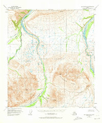
1950 Map of Mount Hayes D-6
USGS Topo · Published 1972About this map
Fort Greely Military Reservation dominates this 1950s interior Alaskan landscape, marking a period when military infrastructure and training grounds were being firmly established in the territory. The topography is defined by the braided drainage patterns of the Little Delta River and Delta Creek, which flow northward from the high peaks. The terrain transitions from these broad river valleys into the steep elevations of Molybdenum Ridge, illustrating the transition from glacial outwash plains to the front ranges of the Alaska Range.
Find a feature on this map
14 named features on this map. Tap any name to fly to it.
Don’t see what you’re looking for? This feature index may not catch every label — zoom into the map to look around manually.
Map Details
Editions of this 1950 Mount Hayes D-6 Map
2 editions found
Other maps of this area

1949 · Big Delta A-6
USGS Topo · 1:63,360

1949 · Fairbanks A-1
USGS Topo · 1:63,360

1949 · Healy D-1
USGS Topo · 1:63,360

1950 · Fairbanks
USGS Topo · 1:250,000

1950 · Mount Hayes
USGS Topo · 1:250,000

1950 · Big Delta
USGS Topo · 1:250,000

1950 · Big Delta A-5
USGS Topo · 1:63,360

1950 · Mount Hayes D-6
USGS Topo · 1:63,360

1950 · Mount Hayes D-5
USGS Topo · 1:63,360

1951 · Healy
USGS Topo · 1:250,000