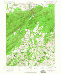
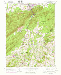
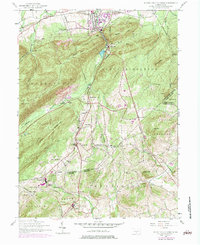
1952 Map of Mount Holly Springs
USGS Topo · Published 1967About this map
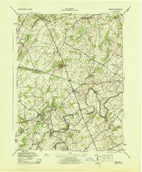
The industrial and residential corridors of Mount Holly Springs anchor this 1952 study, where the Reading railroad follows the winding path of Mountain Creek through a narrow gap in the ridges. The landscape is a mix of small mill settlements and remote mountain landmarks, with Upper Mill and Hunters Run serving as key nodes along the rail line. To the north, the winding Yellow Breeches Creek passes by Barnitz, while the Appalachian Trail traverses the high ground of South Middleton and Rocky Ridge. Rural life is meticulously documented through family-named schools and churches, including Rockeys School and Mt Zion Church. This geography shows the transition from the valley's manufacturing centers to the upland farms of Latimore and Huntington, connected by a network of unimproved roads and small hamlets like Goodyear and Idaville.
Find a feature on this map
55 named features on this map. Tap any name to fly to it.
Don’t see what you’re looking for? This feature index may not catch every label — zoom into the map to look around manually.
Map Details
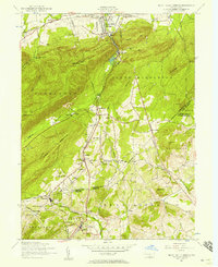
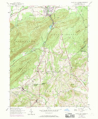
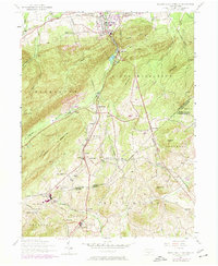
Editions of this 1952 Mount Holly Springs Map
6 editions found
Other maps of this area

1904 · Carlisle
USGS Topo · 1:62,500

1908 · Gettysburg
USGS Topo · 1:62,500

1909 · Fairfield
USGS Topo · 1:62,500

1919 · Newville
USGS Topo · 1:62,500

1942 · Gettysburg
USGS Topo · 1:125,000

1943 · Carlisle
USGS Topo · 1:62,500
1944 · Arendtsville
USGS Topo · 1:31,680
1944 · Biglerville
USGS Topo · 1:31,680
1944 · Hampton
USGS Topo · 1:31,680

1945 · Newville
USGS Topo · 1:62,500
Featured Places
- Latimore Township, PA
- Mount Holly Springs, PA
- Huntington Township, PA
- Starners, Dickinson Township
- Dickinson Township, PA