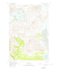
1951 Map of Mount Katmai A-4
USGS Topo · Published 1976About this map
Katmai National Monument encompasses this dramatic volcanic landscape as it was documented in the mid-twentieth century. The terrain is defined by massive peaks including Mt Mageik and the active Trident Volcano, with the high Katmai Pass sitting between major drainage systems. To the south, the glacier-fed waters of Martin Creek and Mageik Creek flow toward the coast, where the broad Katmai River meets the Pacific at Katmai Bay.
Find a feature on this map
16 named features on this map. Tap any name to fly to it.
Don’t see what you’re looking for? This feature index may not catch every label — zoom into the map to look around manually.
Map Details
Editions of this 1951 Mount Katmai A-4 Map
4 editions found
Other maps of this area

1948 · Mt Katmai
USGS Topo · 1:250,000

1951 · Mt Katmai
USGS Topo · 1:250,000

1951 · Karluk
USGS Topo · 1:250,000

1951 · Mount Katmai A-3
USGS Topo · 1:63,360

1951 · Mount Katmai B-4
USGS Topo · 1:63,360

1951 · Karluk D-4
USGS Topo · 1:63,360

1951 · Mount Katmai A-4
USGS Topo · 1:63,360

1951 · Karluk D-5
USGS Topo · 1:63,360

1951 · Mount Katmai B-3
USGS Topo · 1:63,360

1951 · Mount Katmai B-5
USGS Topo · 1:63,360