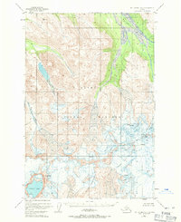
1951 Map of Mount Katmai B-3
USGS Topo · Published 1971About this map
Katmai National Monument preserves a dramatic volcanic landscape as it was documented by photogrammetric methods in the early 1950s. The map centers on the high-altitude terrain surrounding Mt Katmai, where the iconic Crater Lake sits within its caldera. This period of documentation shows the extensive glacial presence and the intricate network of crevasses that defined the slopes of Snowy Mountain and Noisy Mountain before decades of further climatic shifts. In the northern reaches, the Rainbow River and Ikaguik Creek drain the high country, cutting through a wilderness devoid of any established roads or trails. The inclusion of survey markers like VABM 3411 Crater reflects the meticulous effort of the Geological Survey to triangulate this complex Alaskan topography.
Find a feature on this map
10 named features on this map. Tap any name to fly to it.
Don’t see what you’re looking for? This feature index may not catch every label — zoom into the map to look around manually.
Map Details
Editions of this 1951 Mount Katmai B-3 Map
3 editions found
Other maps of this area

1948 · Mt Katmai
USGS Topo · 1:250,000

1951 · Mt Katmai
USGS Topo · 1:250,000

1951 · Mount Katmai A-3
USGS Topo · 1:63,360

1951 · Mount Katmai C-3
USGS Topo · 1:63,360

1951 · Mount Katmai B-4
USGS Topo · 1:63,360

1951 · Mount Katmai C-4
USGS Topo · 1:63,360

1951 · Mount Katmai A-2
USGS Topo · 1:63,360

1951 · Mount Katmai C-2
USGS Topo · 1:63,360

1951 · Mount Katmai A-4
USGS Topo · 1:63,360

1951 · Mount Katmai B-3
USGS Topo · 1:63,360