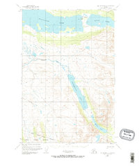
1951 Map of Mount Katmai D-4
USGS Topo · Published 1965About this map
Nonvianuk Lake and Kulik Lake dominate the northern landscape of this 1951 aerial study, illustrating a remote Alaskan wilderness at the edge of the Katmai National Monument. The map documents a sparse human footprint characterized by aviation and history, including a Seaplane Base and Landing Strip situated along the shores of Kulik Lake. A significant cultural marker is noted at the Site of Ancient Village, indicating indigenous heritage along the waterway connecting the larger lakes.
Find a feature on this map
11 named features on this map. Tap any name to fly to it.
Don’t see what you’re looking for? This feature index may not catch every label — zoom into the map to look around manually.
Map Details
Editions of this 1951 Mount Katmai D-4 Map
3 editions found
Other maps of this area

1948 · Mt Katmai
USGS Topo · 1:250,000

1951 · Mt Katmai
USGS Topo · 1:250,000

1951 · Mount Katmai C-3
USGS Topo · 1:63,360

1951 · Mount Katmai D-5
USGS Topo · 1:63,360

1951 · Mount Katmai C-5
USGS Topo · 1:63,360

1951 · Iliamna A-7
USGS Topo · 1:63,360

1951 · Mount Katmai C-4
USGS Topo · 1:63,360

1951 · Mount Katmai D-4
USGS Topo · 1:63,360

1951 · Mount Katmai D-3
USGS Topo · 1:63,360

1951 · Iliamna A-6
USGS Topo · 1:63,360