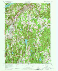
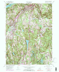
1955 Map of Mount Kisco
USGS Topo · Published 1973About this map
The hills of northern Westchester County and the Connecticut borderlands are defined here by a network of suburban expansion and institutional landmarks during the mid-20th century. Residential clusters at Stanwood and Bedford Hills sit alongside major transit corridors like the Saw Mill River Parkway and the Penn Central rail line. The landscape is notably punctuated by large-scale properties such as the Montefiore Sanatorium and Seven Springs Farm, reflecting an era of transition from rural estates to more structured community planning. Water management is a central theme, evidenced by the New Croton Reservoir in the north and the centrally located Byram Lake Reservoir. Local education and community life are represented by several historic school districts, including the District No 1 Central School, while private recreation is seen at the Mount Kisco Country Club and the Bedford Center and Tennis Club.
Find a feature on this map
56 named features on this map. Tap any name to fly to it.
Don’t see what you’re looking for? This feature index may not catch every label — zoom into the map to look around manually.
Map Details
Editions of this 1955 Mount Kisco Map
5 editions found
Other maps of this area

1892 · Stamford
USGS Topo · 1:62,500

1892 · West Point
USGS Topo · 1:62,500

1892 · Carmel
USGS Topo · 1:62,500

1892 · Tarrytown
USGS Topo · 1:62,500

1893 · Carmel
USGS Topo · 1:62,500

1893 · Stamford
USGS Topo · 1:62,500

1893 · Tarrytown
USGS Topo · 1:62,500

1894 · West Point
USGS Topo · 1:62,500

1894 · Carmel
USGS Topo · 1:62,500

1899 · Stamford
USGS Topo · 1:62,500