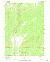
1967 Map of Mount Lena
USGS Topo · Published 1970About this map
The Ashley National Forest dominates this high-altitude landscape of northeast Utah, where the terrain transitions from the deep canyon of Flaming Gorge in the north to the rugged heights of Mount Lena and Limestone Mtn in the south. The 1960s marked a period of significant recreational development following the completion of the Flaming Gorge Dam, evidenced here by the presence of the Grizzly Ridge Winter Sports Area with its ski lifts and the Red Spring Campground. Small settlements and seasonal outposts like Greendale and Stringham Cabin provide anchors for local history, while a network of jeep trails and pack trails navigate the steep drainages of Cart Creek and Greens Draw. The map also captures the high-country boundary between Daggett Co and Uintah Co as it crosses the Base Line surveying marker near Pothole Creek.
Find a feature on this map
32 named features on this map. Tap any name to fly to it.
Don’t see what you’re looking for? This feature index may not catch every label — zoom into the map to look around manually.
Map Details
Editions of this 1967 Mount Lena Map
2 editions found
Other maps of this area

1885 · Ashley
USGS Topo · 1:250,000

1906 · Marsh Peak
USGS Topo · 1:125,000

1908 · Marsh Peak
USGS Topo · 1:125,000

1950 · Burnt Cabin Gorge
USGS Topo · 1:24,000

1950 · Blair Basin
USGS Topo · 1:24,000

1950 · Dyer Mountain
USGS Topo · 1:24,000

1952 · Dutch John Mtn
USGS Topo · 1:24,000

1952 · Goslin Mtn
USGS Topo · 1:24,000

1952 · Flaming Gorge
USGS Topo · 1:24,000

1954 · Vernal
USGS Topo · 1:250,000