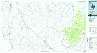
1985 Map of Mount Livermore
USGS Topo · Published 1985About this map
The McDonald Observatory anchors the high ridges of the Davis Mountains, overlooking a landscape defined by dramatic basin-and-range geology in Far West Texas. The Southern Pacific railroad cuts a diagonal line across the desert floor, connecting small sidings and outposts like Lobo, Chispa, and Valentine. This era of the mid-1980s shows the region’s long-standing reliance on transcontinental rail and scattered ranching, with the Plata Verde Mines and various quarries indicating the localized mineral extraction that shaped the early economy.
Find a feature on this map
181 named features on this map. Tap any name to fly to it.
Don’t see what you’re looking for? This feature index may not catch every label — zoom into the map to look around manually.
Map Details
Editions of this 1985 Mount Livermore Map
3 editions found
Other maps of this area

1892 · Chispa
USGS Topo · 1:125,000

1894 · Valentine
USGS Topo · 1:125,000

1894 · Fort Davis
USGS Topo · 1:125,000

1895 · Chispa
USGS Topo · 1:125,000

1895 · Marfa
USGS Topo · 1:125,000

1895 · Sierra Blanca
USGS Topo · 1:125,000

1895 · Alpine
USGS Topo · 1:125,000

1896 · San Carlos
USGS Topo · 1:125,000

1897 · Valentine
USGS Topo · 1:125,000

1897 · Fort Davis
USGS Topo · 1:125,000