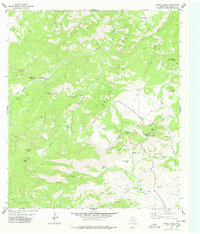
1978 Map of Mount Locke
USGS Topo · Published 1978About this map
The McDonald Observatory sits atop Mount Locke, dominating this high-altitude landscape of the Davis Mountains as it appeared in the late 1970s. This survey records a complex network of water management features essential for ranching and scientific operations in an arid climate, including Limpia Windmill, Salcido Windmill, and numerous catchment basins like Prude Tank and Agua Blanca Tank. The topography is defined by the massive spine of Gavina Ridge and the deep incisions of Madera Canyon, where the Madera Canyon Roadside Park provided a stopping point for travelers along the mountain roads. Notable natural water sources such as Pine Peak Spring and Tuly Spring are documented alongside a web of jeep trails that navigate the high gaps and peaks, reflecting the region's historical reliance on seasonal springs and groundwater for both livestock and the growing astronomical research community.
Find a feature on this map
45 named features on this map. Tap any name to fly to it.
Don’t see what you’re looking for? This feature index may not catch every label — zoom into the map to look around manually.
Map Details
Editions of this 1978 Mount Locke Map
2 editions found
Other maps of this area

1894 · Valentine
USGS Topo · 1:125,000

1894 · Fort Davis
USGS Topo · 1:125,000

1897 · Valentine
USGS Topo · 1:125,000

1897 · Fort Davis
USGS Topo · 1:125,000

1943 · Valentine
USGS Topo · 1:125,000

1954 · Fort Stockton
USGS Topo · 1:250,000

1958 · Fort Stockton
USGS Topo · 1:250,000

1959 · Marfa
USGS Topo · 1:250,000

1965 · Marfa
USGS Topo · 1:250,000

1972 · Casket Mountain
USGS Topo · 1:24,000