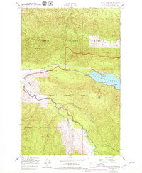
1950 Map of Mount Muller
USGS Topo · Published 1979About this map
Lake Crescent dominates the eastern edge of this landscape, its western shore marked by points such as Thompson Pt and Meldrim Pt. The small settlement of Fairholm serves as a transition between the water and the rising terrain of the Olympic Peninsula. Transportation history is deeply etched into the topography here, showing the route of the Olympic Railroad and an Old Railroad Grade that winds through the northern slopes, alongside the Olympic Highway.
Find a feature on this map
26 named features on this map. Tap any name to fly to it.
Don’t see what you’re looking for? This feature index may not catch every label — zoom into the map to look around manually.
Map Details
Editions of this 1950 Mount Muller Map
4 editions found
Other maps of this area

1918 · Lake Crescent
USGS Topo · 1:62,500

1922 · Pysht
USGS Topo · 1:62,500

1922 · Lake Crescent
USGS Topo · 1:62,500

1939 · Mount Tom
USGS Topo · 1:62,500

1942 · Pysht
USGS Topo · 1:62,500

1943 · Spruce Mountain
USGS Topo · 1:62,500

1943 · Copalis Beach
USGS Topo · 1:250,000

1950 · Mount Muller
USGS Topo · 1:24,000

1950 · Twin Rivers
USGS Topo · 1:24,000
1950 · Disque
USGS Topo · 1:24,000