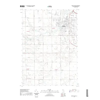
2019 Map of Mount Pleasant
USGS Topo · Published 2019About this map
Mount Pleasant serves as the regional hub in this Isabella County survey, with the extensive campus of Central Michigan University and the Isabella County Courthouse forming the civic core. The landscape is defined by the winding course of the Chippewa River and its various tributaries, including the N Br Chippewa River and Mission Cr. Outside the main city center, the agricultural character of the region is evident in the grid of rural roads and the small settlement of Crawford to the south. Genealogists will find several local burial sites documented across the township, such as Calvary Cem, Mission Creek Cem, Lincoln Cem, and Green Cem. The map also details numerous small water bodies and drainage systems like McLaughlin Lake, Pelis Lake, and Wyant Drain that dictate the local drainage patterns into the larger river basin.
Find a feature on this map
147 named features on this map. Tap any name to fly to it.
Don’t see what you’re looking for? This feature index may not catch every label — zoom into the map to look around manually.
Map Details
Editions of this 2019 Mount Pleasant Map
This is the sole edition of this map. No revisions or reprints were ever made.
Other maps of this area

1916 · Mount Pleasant
USGS Topo · 1:62,500

1919 · Mount Pleasant
USGS Topo · 1:62,500

1930 · Shepherd
USGS Topo · 1:48,000

1935 · Alma
USGS Topo · 1:62,500

1936 · Shepherd
USGS Topo · 1:62,500

1938 · Alma
USGS Topo · 1:62,500

1943 · Mount Pleasant
USGS Topo · 1:62,500

1954 · Midland
USGS Topo · 1:250,000

1958 · Midland
USGS Topo · 1:250,000

1959 · Midland
USGS Topo · 1:250,000