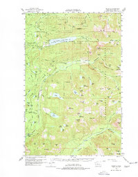
1960 Map of Mount Si
USGS Topo · Published 1976About this map
Mount Si and Mt Teneriffe dominate the southern landscape of this 1960s study, an area defined by steep timberlands and the critical Tolt-Seattle Water Supply Res. The map documents the extensive hydrological management of the region, showing the Snoqualmie Watershed Boundary and numerous gaging stations along the South Fork Tolt River and North Fork Snoqualmie River. Beyond the water infrastructure, the industrial footprint of the Snoqualmie National Forest is evident through an intricate network of logging spurs and borrow pits.
Find a feature on this map
112 named features on this map. Tap any name to fly to it.
Don’t see what you’re looking for? This feature index may not catch every label — zoom into the map to look around manually.
Map Details
Editions of this 1960 Mount Si Map
3 editions found

Other maps of this area

1901 · Snoqualmie Pass
USGS Topo · 1:125,000

1902 · Skykomish
USGS Topo · 1:125,000

1903 · Snoqualmie
USGS Topo · 1:125,000

1905 · Skykomish
USGS Topo · 1:125,000

1913 · Cedar Lake
USGS Topo · 1:125,000

1921 · Sultan
USGS Topo · 1:125,000

1923 · Sultan
USGS Topo · 1:125,000

1953 · Snoqualmie
USGS Topo · 1:24,000

1953 · North Bend
USGS Topo · 1:24,000

1953 · Sultan
USGS Topo · 1:24,000