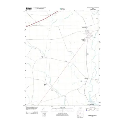
2010 Map of Mount Sterling
USGS Topo · Published 2010About this map
Mount Sterling serves as the primary hub of this central Ohio landscape, where the Mount Sterling Post Office and residential areas like Burr Oaks Heights gather near the banks of Deer Creek. The terrain is defined by an extensive network of agrarian waterways, including Bradford Creek, North Fork Paint Creek, and numerous man-made drainage systems like Bragg Ditch and Galbreath Ditch. These waterways historically dictated the placement of small rural clusters such as McClimansville and Chenoweth.
Find a feature on this map
57 named features on this map. Tap any name to fly to it.
Don’t see what you’re looking for? This feature index may not catch every label — zoom into the map to look around manually.
Map Details
Editions of this 2010 Mount Sterling Map
This is the sole edition of this map. No revisions or reprints were ever made.
Other maps of this area

1906 · Mt Sterling
USGS Topo · 1:62,500

1907 · London
USGS Topo · 1:62,500

1911 · Era
USGS Topo · 1:62,500

1913 · Era
USGS Topo · 1:62,500

1923 · West Columbus
USGS Topo · 1:62,500

1925 · West Columbus
USGS Topo · 1:62,500

1943 · Era
USGS Topo · 1:62,500

1947 · Columbus
USGS Topo · 1:250,000

1955 · Harrisburg
USGS Topo · 1:24,000
1958 · Five Points
USGS Topo · 1:24,000