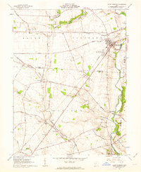
1961 Map of Mount Sterling
USGS Topo · Published 1963About this map
Deer Creek meanders along the eastern edge of this agricultural landscape in the Virginia Military District, where the Baltimore and Ohio railroad serves as a primary corridor for local commerce. The village of Mount Sterling anchors the region, characterized by a mix of early 1960s residential development at Burr Oaks Heights and essential infrastructure like the sewage disposal plant and landing strip. To the south, the village of Madison Mills sits at a critical junction near North Fork Paint Creek, surrounded by scattered family cemeteries and grain storage facilities.
Find a feature on this map
55 named features on this map. Tap any name to fly to it.
Don’t see what you’re looking for? This feature index may not catch every label — zoom into the map to look around manually.
Map Details
Editions of this 1961 Mount Sterling Map
2 editions found
Other maps of this area

1906 · Mt Sterling
USGS Topo · 1:62,500

1907 · London
USGS Topo · 1:62,500

1911 · Era
USGS Topo · 1:62,500

1913 · Era
USGS Topo · 1:62,500

1923 · West Columbus
USGS Topo · 1:62,500

1925 · West Columbus
USGS Topo · 1:62,500

1943 · Era
USGS Topo · 1:62,500

1947 · Columbus
USGS Topo · 1:250,000

1955 · Harrisburg
USGS Topo · 1:24,000
1958 · Five Points
USGS Topo · 1:24,000