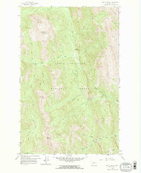
1958 Map of Mount Wright
USGS Topo · Published 1968About this map
Lewis and Clark National Forest dominates this landscape, defined by the sharp elevations of the Rocky Mountain Front during the late 1950s. The drainage system of the North Fork Teton River serves as the primary orientation point, with various forks and gulches like Garners Gulch and Waldron Creek carving through the high country. Human presence is sparse and functional, centered on backcountry management and shelter at the West Fork Ranger Station and the Empty Jug Cabin. Surveyed peaks such as Mount Wright and Mount Lockhart provide critical landmarks for navigating the steep terrain. The network of primitive trails, including the designated Pack Trail, indicates the era's reliance on traditional movement through the wilderness for forest service operations and outdoor recreation before more modern road infrastructure expanded into these basins.
Find a feature on this map
24 named features on this map. Tap any name to fly to it.
Don’t see what you’re looking for? This feature index may not catch every label — zoom into the map to look around manually.
Map Details
Editions of this 1958 Mount Wright Map
3 editions found
Other maps of this area

1903 · Saypo
USGS Topo · 1:125,000

1914 · Heart Butte
USGS Topo · 1:125,000

1918 · Heart Butte
USGS Topo · 1:125,000

1955 · Choteau
USGS Topo · 1:250,000

1957 · Choteau
USGS Topo · 1:250,000

1958 · Choteau
USGS Topo · 1:250,000

1958 · Ear Mountain
USGS Topo · 1:24,000

1958 · Cave Mountain
USGS Topo · 1:24,000

1958 · Porphyry Reef
USGS Topo · 1:24,000

1958 · Mount Wright
USGS Topo · 1:24,000