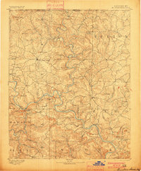
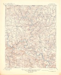
1894 Map of Mountain Home
USGS Topo · Published 1900About this map
The Mountain Home plateau and the surrounding Ozark river valleys dominate this landscape, surveyed just before the turn of the century. The White River snakes through the center of the region, its deep meanders carved into the limestone bluffs, joined by the Buffalo Fork near Buffalo City. This era predates the major dam projects that would later transform the river into a series of lakes, showing the original course and the early settlements that relied on these waters. Local life in the 1890s centered on scattered upland communities like Gassville, Elizabeth, and Wild Cherry, while river towns like Calico Rock and Henderson served as vital nodes for transport and commerce. Notable landmarks such as Stair Bluff, Naked Joe, and the Three Brothers peaks provide fixed points for genealogists and local historians tracing the early land patents and family homesteads of Baxter and Izard counties.
Find a feature on this map
93 named features on this map. Tap any name to fly to it.
Don’t see what you’re looking for? This feature index may not catch every label — zoom into the map to look around manually.
Map Details
Editions of this 1894 Mountain Home Map
6 editions found
Other maps of this area

1890 · Batesville
USGS Topo · 1:125,000

1890 · Mountain Home
USGS Topo · 1:125,000

1891 · Mountain Home
USGS Topo · 1:125,000

1891 · Batesville
USGS Topo · 1:125,000

1892 · Marshall
USGS Topo · 1:125,000

1892 · Mountain View
USGS Topo · 1:125,000

1893 · Yellville
USGS Topo · 1:125,000

1894 · Mountain View
USGS Topo · 1:125,000

1894 · Mountain Home
USGS Topo · 1:125,000

1894 · Marshall
USGS Topo · 1:125,000