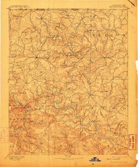
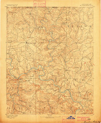
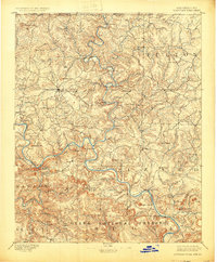
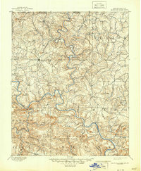
1894 Map of Mountain Home
USGS Topo · Published 1910About this map
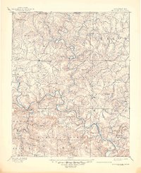
The White River and Buffalo River carve a winding course through North Central Arkansas in this 1890s survey, defining a landscape where travel was dictated by the water. Before modern bridges, a series of river crossings like Shipps Fy. and Traceys Fy & F.D. served as vital links between the Ozark highlands and riverside communities. This era shows Mountain Home and Calico Rock as established hubs, while smaller settlements such as Buffalo City and Lone Rock sit near the confluence of major streams. The map records numerous family-named high points, including Matney Knob and Wallace Knob, which provide a detailed look at the rural topography and land ownership patterns of the late 19th century.
Find a feature on this map
89 named features on this map. Tap any name to fly to it.
Don’t see what you’re looking for? This feature index may not catch every label — zoom into the map to look around manually.
Map Details
Editions of this 1894 Mountain Home Map
6 editions found
Other maps of this area

1890 · Batesville
USGS Topo · 1:125,000

1890 · Mountain Home
USGS Topo · 1:125,000

1891 · Mountain Home
USGS Topo · 1:125,000

1891 · Batesville
USGS Topo · 1:125,000

1892 · Marshall
USGS Topo · 1:125,000

1892 · Mountain View
USGS Topo · 1:125,000

1893 · Yellville
USGS Topo · 1:125,000

1894 · Mountain View
USGS Topo · 1:125,000

1894 · Mountain Home
USGS Topo · 1:125,000

1894 · Marshall
USGS Topo · 1:125,000