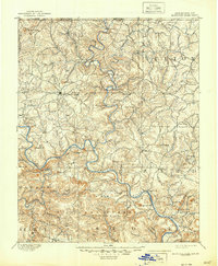
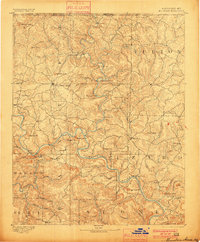
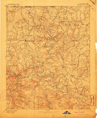
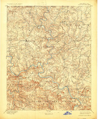
1894 Map of Mountain Home
USGS Topo · Published 1944About this map
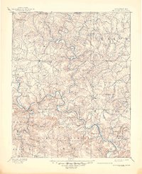
Mountain Home serves as the central hub for this late 19th-century landscape where transportation was dictated by the winding path of the White River and the North Fork White River. This survey, conducted in 1890, captures a pre-dam era where river crossings were essential to local commerce and travel. A dense network of ferries and fords, such as Shipps Fy., Traceys Fy., and Conley Fd., provided the only reliable transit points between the isolated settlements of Baxter and Izard counties. The map provides a detailed look at the rugged Ozark interior, including landmarks like Buzzard Roost Falls and several family-named peaks such as Wallace Knob and Warner Mt.. To the south, the early boundaries of the Ozark National Forest define the wilderness character of the region near Big Flat and Calico Rock.
Find a feature on this map
74 named features on this map. Tap any name to fly to it.
Don’t see what you’re looking for? This feature index may not catch every label — zoom into the map to look around manually.
Map Details
Editions of this 1894 Mountain Home Map
6 editions found
Other maps of this area

1890 · Batesville
USGS Topo · 1:125,000

1890 · Mountain Home
USGS Topo · 1:125,000

1891 · Mountain Home
USGS Topo · 1:125,000

1891 · Batesville
USGS Topo · 1:125,000

1892 · Marshall
USGS Topo · 1:125,000

1892 · Mountain View
USGS Topo · 1:125,000

1893 · Yellville
USGS Topo · 1:125,000

1894 · Mountain View
USGS Topo · 1:125,000

1894 · Mountain Home
USGS Topo · 1:125,000

1894 · Marshall
USGS Topo · 1:125,000