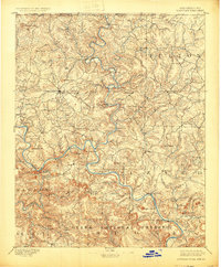
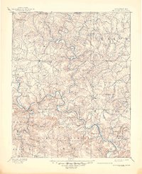
1894 Map of Mountain Home
USGS Topo · Published 1925About this map
The North Fork White River carves a winding path through the Ozark landscape on this late 19th-century survey, meeting the larger White River near the settlement of Buffalo City. This era shows the region as a network of isolated upland communities and river-dependent hubs, long before the construction of major dams would alter these watercourses. Mountain Home serves as the central point of activity, surrounded by scattered locales like Gassville, Elizabeth, and the river town of Calico Rock.
Find a feature on this map
61 named features on this map. Tap any name to fly to it.
Don’t see what you’re looking for? This feature index may not catch every label — zoom into the map to look around manually.
Map Details
Editions of this 1894 Mountain Home Map
6 editions found
Other maps of this area

1890 · Batesville
USGS Topo · 1:125,000

1890 · Mountain Home
USGS Topo · 1:125,000

1891 · Mountain Home
USGS Topo · 1:125,000

1891 · Batesville
USGS Topo · 1:125,000

1892 · Marshall
USGS Topo · 1:125,000

1892 · Mountain View
USGS Topo · 1:125,000

1893 · Yellville
USGS Topo · 1:125,000

1894 · Mountain View
USGS Topo · 1:125,000

1894 · Mountain Home
USGS Topo · 1:125,000

1894 · Marshall
USGS Topo · 1:125,000