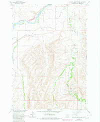
1964 Map of Mountain Pocket Creek
USGS Topo · Published 1980About this map
The Bighorn Canyon National Recreation Area dominates the northwest corner of this landscape, where the Bighorn River cuts through the terrain of the Crow Indian Reservation. This 1960s survey, updated in 1980, captures a region defined by water management and resource extraction. The Big Horn Canal and various ditch systems distribute water through the valleys, while the Soap Creek Oil Field and numerous pipelines mark the industrial activity in the southeast.
Find a feature on this map
15 named features on this map. Tap any name to fly to it.
Don’t see what you’re looking for? This feature index may not catch every label — zoom into the map to look around manually.
Map Details
Editions of this 1964 Mountain Pocket Creek Map
2 editions found
Other maps of this area

1894 · St. Xavier
USGS Topo · 1:125,000

1901 · St. Xavier
USGS Topo · 1:125,000

1915 · Spenceville
USGS Topo · 1:31,680

1954 · Hardin
USGS Topo · 1:250,000

1957 · Hardin
USGS Topo · 1:250,000

1958 · Hardin
USGS Topo · 1:250,000

1960 · St Xavier
USGS Topo · 1:24,000

1960 · Mission Coulee
USGS Topo · 1:24,000

1964 · Peyote Point
USGS Topo · 1:24,000
1964 · Mountain Pocket Creek
USGS Topo · 1:24,000