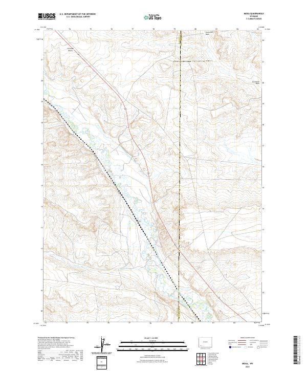
2021 Map of Moxa
USGS Topo · Published 2021About this map
Hams Fork winds through the high plains of southwestern Wyoming, anchoring a landscape defined by its historical water management systems. This 2021 survey illustrates the extensive network of irrigation infrastructure essential to the region, featuring named canals such as the Fabian and Tyler Ditch, Philbrick and Johnson Ditch, and Moore and Bagley Ditch. These waterways reflect the agricultural engineering required to sustain the settlement at Moxa and surrounding lands along the county line between Lincoln and Sweetwater counties. The terrain is further etched by seasonal drainages like Zieglers Wash and Sevenmile Wash, which define the drainage patterns surrounding the local ranching and transit corridors. The map provides a contemporary look at the persistent relationship between the river and the man-made diversions that have shaped this corner of the state for generations.
Find a feature on this map
15 named features on this map. Tap any name to fly to it.
Don’t see what you’re looking for? This feature index may not catch every label — zoom into the map to look around manually.
Map Details
Editions of this 2021 Moxa Map
This is the sole edition of this map. No revisions or reprints were ever made.
Other maps of this area

1954 · Ogden
USGS Topo · 1:250,000

1954 · Rock Springs
USGS Topo · 1:250,000

1958 · Ogden
USGS Topo · 1:250,000

1958 · Rock Springs
USGS Topo · 1:250,000

1960 · Ogden
USGS Topo · 1:250,000

1961 · Sevenmile Gulch
USGS Topo · 1:24,000

1961 · Granger
USGS Topo · 1:24,000

1962 · Rock Springs
USGS Topo · 1:250,000
1963 · Whiskey Buttes
USGS Topo · 1:24,000

1969 · Church Butte NW
USGS Topo · 1:24,000