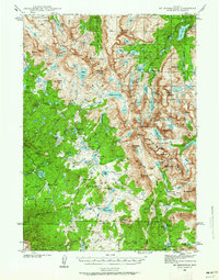
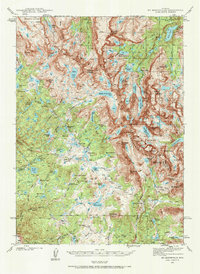
1938 Map of Mt Bonneville
USGS Topo · Published 1962About this map
Mt Bonneville and the high Continental Divide define this wilderness landscape in the late 1930s, straddling the boundary of Fremont and Sublette counties. Surveyed before the era of modern road expansion, the map reveals a complex network of high-altitude paths like the Washakie Trail and Scab Creek Trail that provided essential access for forest management and recreation. Human presence is sparse, marked by the South Fork Guard Sta, a seasonal Cow Camp, and the John Day Cabin at lower elevations.
Find a feature on this map
92 named features on this map. Tap any name to fly to it.
Don’t see what you’re looking for? This feature index may not catch every label — zoom into the map to look around manually.
Map Details
Editions of this 1938 Mt Bonneville Map
6 editions found
Other maps of this area

1909 · Fremont Peak
USGS Topo · 1:125,000

1937 · Moccasin Lake
USGS Topo · 1:48,000

1938 · Mt Bonneville
USGS Topo · 1:62,500

1941 · Mt Bonneville
USGS Topo · 1:62,500

1942 · Mt Bonneville
USGS Topo · 1:62,500

1943 · Moccasin Lake
USGS Topo · 1:62,500

1952 · Paradise Basin
USGS Topo · 1:24,000

1952 · St. Lawrence Basin
USGS Topo · 1:24,000

1952 · Alpine Lake
USGS Topo · 1:24,000

1955 · Thermopolis
USGS Topo · 1:250,000