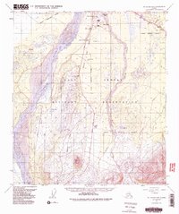
1950 Map of Mt. Hayes D-1
USGS Topo · Published 1989About this map
Fort Greely dominates the interior landscape of this 1950s-era survey, situated where the glacial waters of the Delta River and Jarvis Creek converge. The infrastructure of the Cold War and the later industrial development of the state are clearly visible, including the Trans-Alaska Pipeline corridor running parallel to the Richardson Highway. This corridor passes by Pumping Station No 9, marking a critical juncture in the region's energy logistics.
Find a feature on this map
21 named features on this map. Tap any name to fly to it.
Don’t see what you’re looking for? This feature index may not catch every label — zoom into the map to look around manually.
Map Details
Editions of this 1950 Mt. Hayes D-1 Map
5 editions found
Other maps of this area

1950 · Mount Hayes
USGS Topo · 1:250,000

1950 · Big Delta
USGS Topo · 1:250,000

1950 · Big Delta A-5
USGS Topo · 1:63,360

1950 · Mount Hayes D-4
USGS Topo · 1:63,360

1950 · Mount Hayes C-4
USGS Topo · 1:63,360

1950 · Big Delta A-4
USGS Topo · 1:63,360

1950 · Mount Hayes D-5
USGS Topo · 1:63,360

1951 · Big Delta
USGS Topo · 1:250,000

1951 · Mount Hayes
USGS Topo · 1:250,000

1951 · Mount Hayes C-5
USGS Topo · 1:63,360