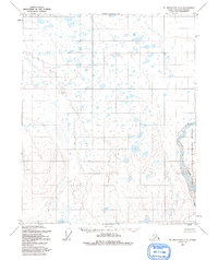
1955 Map of Mt. Michelson D-5
USGS Topo · Published 1992About this map
The Canning River carves a distinct path through the eastern portion of this northern landscape, forming a natural boundary within the Arctic National Wildlife Refuge. Based on 1955 photogrammetry, the terrain is characterized by a high concentration of small lakes and ponds in the north, giving way to more defined contour elevations as one moves south toward the foothills. This specific quadrangle, prepared by the Department of the Interior Geological Survey, illustrates a wilderness expanse devoid of permanent roads or structures at the time of the original photography. The map's data reveals the complex hydrology of the North Slope, where the intricate network of water bodies and the broad braided channel of the Canning River dominate the environmental character of the region during the mid-century period.
Find a feature on this map
2 named features on this map. Tap any name to fly to it.
Don’t see what you’re looking for? This feature index may not catch every label — zoom into the map to look around manually.
Map Details
Editions of this 1955 Mt. Michelson D-5 Map
2 editions found
Other maps of this area

1951 · Beechey Point
USGS Topo · 1:250,000

1951 · Sagavanirktok D-5
USGS Topo · 1:250,000

1951 · Mt. Michelson
USGS Topo · 1:250,000

1955 · Flaxman Island
USGS Topo · 1:250,000

1955 · Beechey Point
USGS Topo · 1:250,000

1955 · Mount Michelson C-5
USGS Topo · 1:63,360

1955 · Mount Michelson D-5
USGS Topo · 1:63,360

1955 · Mount Michelson C-4
USGS Topo · 1:63,360

1955 · Mount Michelson D-4
USGS Topo · 1:63,360

1955 · Flaxman Island A-5
USGS Topo · 1:63,360