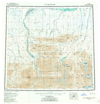
1956 Map of Mt. Michelson
USGS Topo · Published 1962About this map
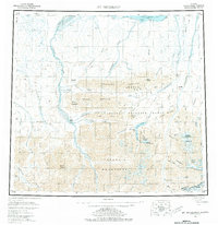
The Arctic National Wildlife Range dominates this mid-century survey of Alaska's North Slope, where the northern foothills of the Brooks Range meet the coastal plain of Camden Bay. The landscape is defined by the high peaks of the Franklin Mountains and Romanzof Mountains, including Mount Michelson and Mount Chamberlin. Large braided river systems, notably the Canning River and the Hulahula River, cut through the terrain toward the Beaufort Sea. A Tractor Trail following the coastline near Simpson Cove and Collinson Pt provides the only evidence of overland transport in this remote region. The map captures a moment before modern infrastructure, detailing geological landmarks such as Sadlerochit Spring and the distinctive Sadlerochit Mountains during an era of significant aerial survey and Arctic study.
Find a feature on this map
72 named features on this map. Tap any name to fly to it.
Don’t see what you’re looking for? This feature index may not catch every label — zoom into the map to look around manually.
Map Details
Editions of this 1956 Mt. Michelson Map
8 editions found

Other maps of this area

1951 · Beechey Point
USGS Topo · 1:250,000

1951 · Barter Island
USGS Topo · 1:250,000

1951 · Sagavanirktok D-5
USGS Topo · 1:250,000

1951 · Demarcation Point
USGS Topo · 1:250,000

1951 · Brooks
USGS Topo · 1:250,000

1951 · Arctic
USGS Topo · 1:250,000

1951 · Table Mountain
USGS Topo · 1:250,000

1951 · Mt. Michelson
USGS Topo · 1:250,000

1955 · Flaxman Island
USGS Topo · 1:250,000

1955 · Demarcation Point
USGS Topo · 1:250,000