1946 Map of Mt. Mitchell
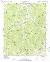
USGS Topo · Published 1971About this map
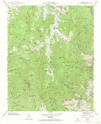
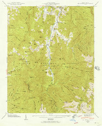
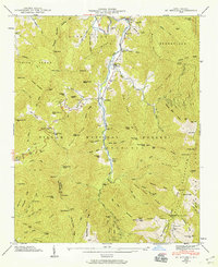
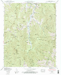
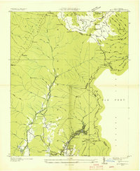
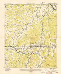
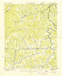
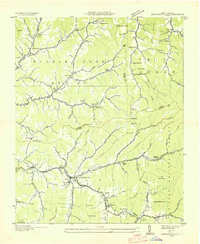
Pensacola and the small valley settlements of Murchison and Dakota sit along the winding Cane River in the heart of the Pisgah National Forest. This 1946 field examination captures the high-altitude landscape of the Black Mountains, where several family cemeteries—including Harwood Cem, Ray Cem, and Penland Cem—mark the presence of early mountain homesteads. The terrain is defined by extreme relief, rising from the river valley to prominent summits like Big Butt and Big Pine Mountain, culminating near the Lookout Tower on the state's highest peaks. A single Toll Gate at Dakota suggests the era's controlled access into the deep wilderness of the southern Appalachians. Researchers will find numerous named gaps and ridges, such as Cane River Gap and Brush Fence Ridge, that reflect the traditional land use and livestock patterns of North Carolina's high country before modern development.
Find a feature on this map
95 named features on this map. Tap any name to fly to it.
Don’t see what you’re looking for? This feature index may not catch every label — zoom into the map to look around manually.
Map Details
Editions of this 1946 Mt. Mitchell Map
5 editions found
Other maps of this area

1900 · Mount Mitchell
USGS Topo · 1:125,000

1902 · Mount Mitchell
USGS Topo · 1:125,000

1934 · Micaville
USGS Topo · 1:24,000

1934 · Parts Of Celo And Black Brothers
USGS Topo · 1:24,000

1934 · Parts Of Old Fort and Montreat
USGS Topo · 1:24,000
1935 · Montreat
USGS Topo · 1:24,000

1935 · Black Brothers
USGS Topo · 1:24,000
1935 · Burnsville
USGS Topo · 1:24,000
1935 · Bald Creek
USGS Topo · 1:24,000
1935 · Barnardsville
USGS Topo · 1:24,000