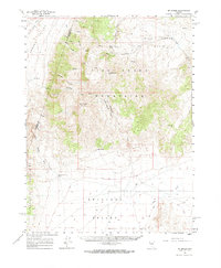
1961 Map of Mt. Moses
USGS Topo · Published 1970About this map
Mt Moses stands as the central landmark of this high-desert region of Nevada, where the Fish Creek Mountains and Augusta Mountains converge. The landscape is defined by vast drainage systems and seasonal basins, including the expansive Antelope Valley and the Fish Creek Basin. This 1961 survey captures the network of remote mountain crossings such as Cottonwood Pass and Daisy Pass, which provided vital transit through the highlands during the mid-20th century.
Find a feature on this map
30 named features on this map. Tap any name to fly to it.
Don’t see what you’re looking for? This feature index may not catch every label — zoom into the map to look around manually.
Map Details
Editions of this 1961 Mt. Moses Map
3 editions found

Other maps of this area

1932 · Sonoma Range
USGS Topo · 1:250,000

1939 · Sonoma Range
USGS Topo · 1:250,000

1955 · Millett
USGS Topo · 1:250,000

1955 · Winnemucca
USGS Topo · 1:250,000

1958 · Winnemucca
USGS Topo · 1:250,000

1959 · Millett
USGS Topo · 1:250,000

1961 · McCoy
USGS Topo · 1:62,500

1961 · Mt. Tobin
USGS Topo · 1:62,500

1961 · Cain Mountain
USGS Topo · 1:62,500

1961 · The Cedars
USGS Topo · 1:62,500