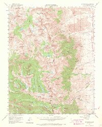
1953 Map of Mt. Pinchot
USGS Topo · Published 1969About this map
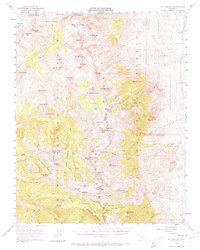
John Muir Trail winds through the high Sierra Nevada in this mid-century survey, crossing the dramatic boundary between Kings Canyon National Park and Inyo National Forest. The map documents a rugged landscape defined by high-altitude glacial features like Sixty Lake Basin, Rae Lakes, and the Kearsarge Pinnacles. The eastern slopes above the Owens Valley reveal a legacy of alpine mining, with numerous operations such as the Rex Montis Mine, Glacier Mines, and the Kearsarge Group situated near steep passes. Near the small settlement of Aberdeen, the terrain transitions from the high peaks of Mt Gardiner and Kearsarge Peak down to the springs and gravel pits of the valley floor, including the Declaration Mine (Sand Pit) and Grover Anton Spring.
Find a feature on this map
131 named features on this map. Tap any name to fly to it.
Don’t see what you’re looking for? This feature index may not catch every label — zoom into the map to look around manually.
Map Details
Editions of this 1953 Mt. Pinchot Map
6 editions found

Other maps of this area

1903 · Tehipite
USGS Topo · 1:125,000

1905 · Tehipite
USGS Topo · 1:125,000

1907 · Mt. Whitney
USGS Topo · 1:125,000

1912 · Mt. Goddard
USGS Topo · 1:125,000

1913 · Bishop
USGS Topo · 1:125,000

1919 · Mt. Whitney
USGS Topo · 1:125,000

1937 · Mt. Whitney
USGS Topo · 1:125,000

1947 · Mariposa
USGS Topo · 1:250,000

1948 · Fresno
USGS Topo · 1:250,000

1948 · Mariposa
USGS Topo · 1:250,000