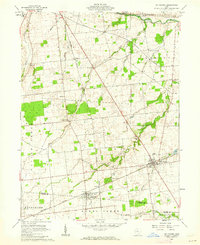
1961 Map of Mt Victory
USGS Topo · Published 1962About this map
The New York Central railroad corridor anchors the landscape of southern Hardin County in the early 1960s, connecting the twin village centers of Mt Victory and Ridgeway. The surrounding terrain, drained by the Scioto River and its tributaries like Wolf Creek and Wildcat Creek, reflects a deeply established agricultural society. The map documents numerous community pillars, from the Amish Sch in the northwest to various rural congregations including Wolf Creek Ch, Otterbein Cem Ch, and Rhinehart Ch. Local family history is preserved through scattered burying grounds such as Hale Cem and Morrison Cem. The presence of small named settlements like Mentzer, Grassy Point, and Browns Crossroads reveals a dispersed population pattern common before the consolidation of larger township hubs.
Find a feature on this map
36 named features on this map. Tap any name to fly to it.
Don’t see what you’re looking for? This feature index may not catch every label — zoom into the map to look around manually.
Map Details
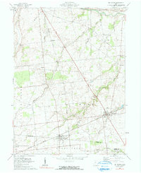
Editions of this 1961 Mt Victory Map
2 editions found
Other maps of this area

1913 · East Liberty
USGS Topo · 1:62,500

1913 · Richwood
USGS Topo · 1:62,500

1915 · Richwood
USGS Topo · 1:62,500

1915 · East Liberty
USGS Topo · 1:62,500

1915 · Kenton
USGS Topo · 1:62,500

1915 · La Rue
USGS Topo · 1:62,500

1944 · East Liberty
USGS Topo · 1:62,500

1944 · Kenton
USGS Topo · 1:62,500

1944 · Richwood
USGS Topo · 1:62,500

1950 · Marion
USGS Topo · 1:250,000