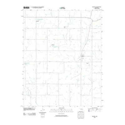
2009 Map of Mulhall
USGS Topo · Published 2009About this map
Mulhall stands as the primary settlement in this portion of Logan County, positioned along the central corridor where the terrain is drained by an extensive network of waterways. The landscape is defined by the branching arms of Beaver Creek, including West Beaver Creek, Middle Beaver Creek, and East Beaver Creek, which converge as they flow southward. In the southwest, Skeleton Creek cuts through the territory, further illustrating the riparian nature of this prairie region.
Find a feature on this map
24 named features on this map. Tap any name to fly to it.
Don’t see what you’re looking for? This feature index may not catch every label — zoom into the map to look around manually.
Map Details
Editions of this 2009 Mulhall Map
This is the sole edition of this map. No revisions or reprints were ever made.
Other maps of this area

1892 · Guthrie
USGS Topo · 1:62,500

1892 · Kingfisher
USGS Topo · 1:125,000

1893 · Mulhall
USGS Topo · 1:62,500

1893 · Lovell
USGS Topo · 1:62,500

1895 · Kingfisher
USGS Topo · 1:125,000

1954 · Oklahoma City
USGS Topo · 1:250,000

1955 · Enid
USGS Topo · 1:250,000

1957 · Oklahoma City
USGS Topo · 1:250,000

1958 · Enid
USGS Topo · 1:250,000

1963 · Oklahoma City
USGS Topo · 1:250,000