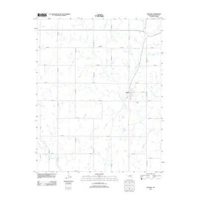
2012 Map of Mulhall
USGS Topo · Published 2012About this map
Mulhall stands as the primary hub of this north-central Oklahoma landscape, situated where the rural road network converges in Logan County. The town's grid, centered on Main St, is bounded to the east by Roselawn Cem, a key site for genealogical research. The surrounding terrain is defined by the complex drainage of the Beaver Cr system, with its various branches including Middle Beaver Cr, E Beaver Cr, and W Beaver Cr carving subtle paths through the prairie. Further south, Skeleton Cr cuts across the southwestern portion of the sheet. To the north, the isolated Pleasant Valley Cem sits among the section-line roads like N Coltrane Rd and E0630 Rd, marking the site of early community gatherings and family plots that predate the modern highway system.
Find a feature on this map
26 named features on this map. Tap any name to fly to it.
Don’t see what you’re looking for? This feature index may not catch every label — zoom into the map to look around manually.
Map Details
Editions of this 2012 Mulhall Map
This is the sole edition of this map. No revisions or reprints were ever made.
Other maps of this area

1892 · Guthrie
USGS Topo · 1:62,500

1892 · Kingfisher
USGS Topo · 1:125,000

1893 · Mulhall
USGS Topo · 1:62,500

1893 · Lovell
USGS Topo · 1:62,500

1895 · Kingfisher
USGS Topo · 1:125,000

1954 · Oklahoma City
USGS Topo · 1:250,000

1955 · Enid
USGS Topo · 1:250,000

1957 · Oklahoma City
USGS Topo · 1:250,000

1958 · Enid
USGS Topo · 1:250,000

1963 · Oklahoma City
USGS Topo · 1:250,000