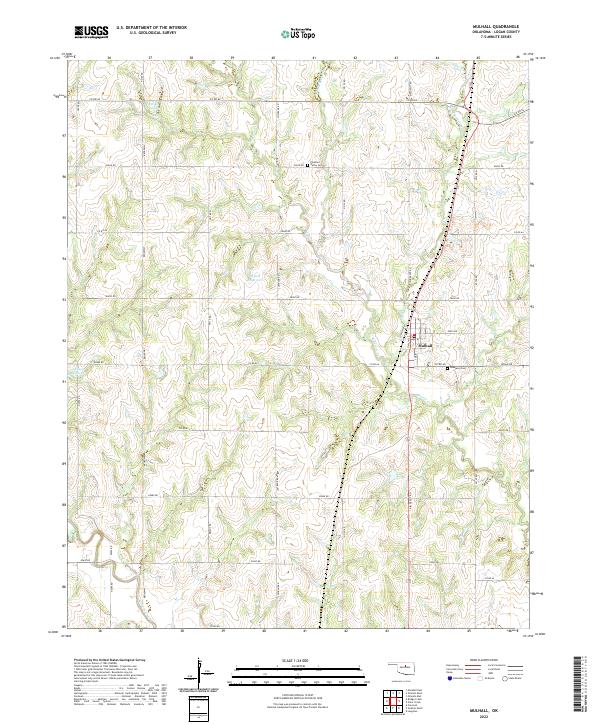
2022 Map of Mulhall
USGS Topo · Published 2022About this map
The town of Mulhall sits at the heart of this Logan County landscape, centered along a grid of local roads and the primary north-south corridor of S Main. This area of the Oklahoma prairie is defined by the dendritic drainage patterns of Beaver Creek and its various tributaries, including W Beaver Cr, Middle Beaver Cr, and E Beaver Cr. The land is dotted with several small reservoirs, such as 083040 Reservoir and 083021 Reservoir, reflecting the rural water management of the region.
Find a feature on this map
42 named features on this map. Tap any name to fly to it.
Don’t see what you’re looking for? This feature index may not catch every label — zoom into the map to look around manually.
Map Details
Editions of this 2022 Mulhall Map
This is the sole edition of this map. No revisions or reprints were ever made.
Other maps of this area

1892 · Guthrie
USGS Topo · 1:62,500

1892 · Kingfisher
USGS Topo · 1:125,000

1893 · Mulhall
USGS Topo · 1:62,500

1893 · Lovell
USGS Topo · 1:62,500

1895 · Kingfisher
USGS Topo · 1:125,000

1954 · Oklahoma City
USGS Topo · 1:250,000

1955 · Enid
USGS Topo · 1:250,000

1957 · Oklahoma City
USGS Topo · 1:250,000

1958 · Enid
USGS Topo · 1:250,000

1963 · Oklahoma City
USGS Topo · 1:250,000