Loading...
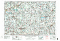
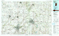
Loading map...1953 Map of Muncie
USGS Topo · Published 1979About this map
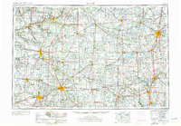
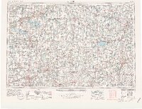
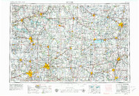
Industrial and agricultural hubs across East Central Indiana and Western Ohio are captured in this 1978 revision of the 1953 survey. The regional landscape is defined by the convergence of major river systems, including the Wabash River and Mississinewa River to the north, and the White River flowing through the manufacturing centers of Muncie and Anderson. The presence of the Prairie Creek Reservoir and the expansive Grand Lake St Marys highlights the mid-century development of water resources for the region's growing population.
Find a feature on this map
166 named features on this map. Tap any name to fly to it.
Don’t see what you’re looking for? This feature index may not catch every label — zoom into the map to look around manually.
Map Details
Date Portrayed1953
Date Published1979
PublisherU.S. Geological Survey
Map TypeTopographic
Scale1:250,000
Physical Dimensions32 x 22.1 inches
Editions of this 1953 Muncie Map
5 editions found

Historical Maps of Fort Wayne Through Time
3 maps found

Featured Locations
Source Details
SourceU.S. Geological Survey
CopyrightPublic Domain