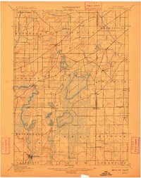
1901 Map of Muskego
USGS Topo · Published 1910About this map
Muskego Lake and the winding course of the Fox River anchor this late 19th-century landscape of southeast Wisconsin. Surveyed in 1890 and 1899, the map reveals a region defined by its diverse glacial lakes and established farming communities. The Wisconsin Central Railroad cuts across the northwest corner near the Waukesha City Line, illustrating the early rail connections that linked these agricultural townships to larger markets.
Find a feature on this map
46 named features on this map. Tap any name to fly to it.
Don’t see what you’re looking for? This feature index may not catch every label — zoom into the map to look around manually.
Map Details
Editions of this 1901 Muskego Map
4 editions found

Other maps of this area

1891 · Bayview
USGS Topo · 1:62,500

1891 · Muskego
USGS Topo · 1:62,500

1892 · Milwaukee
USGS Topo · 1:62,500

1892 · Waukesha
USGS Topo · 1:62,500

1892 · Racine
USGS Topo · 1:62,500

1892 · Oconomowoc
USGS Topo · 1:62,500

1892 · Eagle
USGS Topo · 1:62,500

1893 · Silver Lake
USGS Topo · 1:62,500

1893 · Geneva
USGS Topo · 1:62,500

1894 · Eagle
USGS Topo · 1:62,500