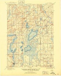
1901 Map of Muskego
USGS Topo · Published 1950About this map
Glacial lakes and marshy lowlands dominate this corner of southeast Wisconsin at the turn of the century, where several townships meet across Waukesha, Racine, and Milwaukee counties. The landscape is defined by the significant waters of Muskego Lake and Wind Lake, connected by a network of smaller basins like Little Muskego Lake and Denoon Lake. In the northwest, the Wisconsin Central Railroad skirts the Waukesha City Line, while the Fox River winds past Big Bend toward the mill site at Waterford. Small crossroads settlements like Tess Corners, Prospect, and Durham serve the surrounding dairy and agricultural lands. The presence of the Union Church at the Racine County border suggests the community centers that anchored these rural townships before modern suburbanization transformed the region.
Find a feature on this map
45 named features on this map. Tap any name to fly to it.
Don’t see what you’re looking for? This feature index may not catch every label — zoom into the map to look around manually.
Map Details
Editions of this 1901 Muskego Map
4 editions found

Other maps of this area

1891 · Bayview
USGS Topo · 1:62,500

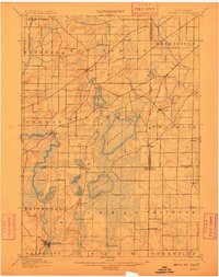
1891 · Muskego
USGS Topo · 1:62,500

1892 · Milwaukee
USGS Topo · 1:62,500

1892 · Waukesha
USGS Topo · 1:62,500

1892 · Racine
USGS Topo · 1:62,500

1892 · Oconomowoc
USGS Topo · 1:62,500

1892 · Eagle
USGS Topo · 1:62,500

1893 · Silver Lake
USGS Topo · 1:62,500

1893 · Geneva
USGS Topo · 1:62,500

1894 · Eagle
USGS Topo · 1:62,500