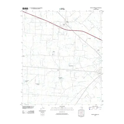
2010 Map of Myrtle Springs
USGS Topo · Published 2010About this map
Myrtle Springs and the northern outskirts of Canton define this East Texas landscape at the start of the 21st century. The map reveals a rural geography heavily shaped by water management and aviation, evidenced by the private airstrip at Denniss Flying Farm Airport and a series of Soil Conservation Service dams, including Soil Conservation Service Site 124 Dam. These structures manage the drainage of the Dry Lacy Fork and Wet Lacy Fork, which feed into the larger creek systems of the region.
Find a feature on this map
80 named features on this map. Tap any name to fly to it.
Don’t see what you’re looking for? This feature index may not catch every label — zoom into the map to look around manually.
Map Details
Editions of this 2010 Myrtle Springs Map
This is the sole edition of this map. No revisions or reprints were ever made.
Other maps of this area

1920 · Kemp
USGS Topo · 1:62,500

1948 · Martins Mill
USGS Topo · 1:62,500

1949 · Martins Mill
USGS Topo · 1:62,500

1954 · Dallas
USGS Topo · 1:250,000

1956 · Tyler
USGS Topo · 1:250,000

1957 · Kemp
USGS Topo · 1:62,500

1958 · Dallas
USGS Topo · 1:250,000

1962 · Myrtle Springs
USGS Topo · 1:24,000

1962 · Prairieville
USGS Topo · 1:24,000

1962 · Cedarvale
USGS Topo · 1:24,000