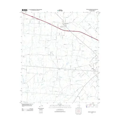
2012 Map of Myrtle Springs
USGS Topo · Published 2012About this map
The community of Myrtle Springs anchors this Northeast Texas landscape, defined by a dense web of county roads and a complex drainage system within Van Zandt County. Interstate 20 bisects the northern half of the region, passing near the uniquely named Dennis's Flying Farm Airport. To the south, the settlement of Wallace sits amidst the meandering branches of the Dry Lacy Fork, while the outskirts of Canton appear in the southeast corner. Genealogists will find several significant burial sites, including the Wesley Chapel Cem and High Cem, which serve as quiet landmarks of the area's rural heritage. The terrain is characterized by numerous small waterways like Caney Cr and Britton Cr, alongside local water features such as City Lake and Spring Lake. This network of creeks and springs suggests a long history of agricultural reliance on the natural watershed before modern infrastructure reshaped the local travel patterns.
Find a feature on this map
111 named features on this map. Tap any name to fly to it.
Don’t see what you’re looking for? This feature index may not catch every label — zoom into the map to look around manually.
Map Details
Editions of this 2012 Myrtle Springs Map
This is the sole edition of this map. No revisions or reprints were ever made.
Other maps of this area

1920 · Kemp
USGS Topo · 1:62,500

1948 · Martins Mill
USGS Topo · 1:62,500

1949 · Martins Mill
USGS Topo · 1:62,500

1954 · Dallas
USGS Topo · 1:250,000

1956 · Tyler
USGS Topo · 1:250,000

1957 · Kemp
USGS Topo · 1:62,500

1958 · Dallas
USGS Topo · 1:250,000

1962 · Myrtle Springs
USGS Topo · 1:24,000

1962 · Prairieville
USGS Topo · 1:24,000

1962 · Cedarvale
USGS Topo · 1:24,000