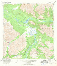
1949 Map of Nabesna D-6
USGS Topo · Published 1970About this map
Mentasta Pass serves as a critical corridor through the landscape, marking a transition between the drainages of Mentasta Creek and the headwaters of the Slana River. This 1940s-era topography reveals a remote interior Alaska where transportation relied heavily on the Glenn Highway and the historic Eagle Trail. A lone Lodge and an adjacent Landing Strip represent the sparse human footprint in this wilderness, situated near the complex hydrology of Slana Slough.
Find a feature on this map
26 named features on this map. Tap any name to fly to it.
Don’t see what you’re looking for? This feature index may not catch every label — zoom into the map to look around manually.
Map Details
Editions of this 1949 Nabesna D-6 Map
5 editions found
Other maps of this area

1948 · Tanacross A-6
USGS Topo · 1:63,360

1948 · Nabesna C-6
USGS Topo · 1:63,360

1948 · Nabesna D-5
USGS Topo · 1:63,360

1948 · Tanacross A-5
USGS Topo · 1:63,360

1949 · Tanacross
USGS Topo · 1:250,000

1949 · Nabesna D-6
USGS Topo · 1:63,360

1949 · Tanacross A-5
USGS Topo · 1:63,360

1949 · Gulkana C-1
USGS Topo · 1:63,360

1949 · Mt. Hayes A-1
USGS Topo · 1:63,360

1950 · Tanacross
USGS Topo · 1:250,000