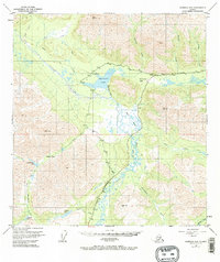
1949 Map of Nabesna D-6
USGS Topo · Published 1970About this map
Mentasta Lake and its surrounding mountain passes dominate this 1949 interior Alaska landscape, captured during a period of transition for northern transportation. The map reveals the critical geographic importance of Mentasta Pass, where the Glenn Highway follows a path through the Mentasta Mountains, paralleling the older historic Eagle Trail. Along the shores of Mentasta Lake, the presence of Ruins and a Lodge near a Landing Strip suggests a mid-century hub for travelers and local transport in an otherwise remote wilderness.
Find a feature on this map
27 named features on this map. Tap any name to fly to it.
Don’t see what you’re looking for? This feature index may not catch every label — zoom into the map to look around manually.
Map Details
Editions of this 1949 Nabesna D-6 Map
5 editions found
Other maps of this area

1948 · Tanacross A-6
USGS Topo · 1:63,360

1948 · Nabesna C-6
USGS Topo · 1:63,360

1948 · Nabesna D-5
USGS Topo · 1:63,360

1948 · Tanacross A-5
USGS Topo · 1:63,360

1949 · Tanacross
USGS Topo · 1:250,000

1949 · Nabesna D-6
USGS Topo · 1:63,360

1949 · Tanacross A-5
USGS Topo · 1:63,360

1949 · Gulkana C-1
USGS Topo · 1:63,360

1949 · Mt. Hayes A-1
USGS Topo · 1:63,360

1950 · Tanacross
USGS Topo · 1:250,000