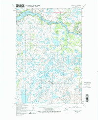
1952 Map of Naknek C-3
USGS Topo · Published 1972About this map
King Salmon and South Naknek anchor the commercial and transportation activity of this Bristol Bay region in the early 1950s. The landscape is defined by the winding course of the Naknek River, which transitions from tidal flats at Coffee Pt near the Cannery to the distinctive Horseshoe Bend further inland. This area, within the Bristol Bay Borough, shows the intersection of aviation and maritime history, evidenced by the presence of Radio Towers near the river's junction with Salmon Creek. Inland, the terrain is a complex network of wetlands and smaller tributaries including Paul's Creek and Smelt Creek. These water-rich lowlands provided the essential infrastructure for the local fishing and canning industries, while remote locations like Savonoski and scattered Cabin sites reflect the subsistence and trapping patterns of the Alaskan interior during this period of mid-century development.
Find a feature on this map
27 named features on this map. Tap any name to fly to it.
Don’t see what you’re looking for? This feature index may not catch every label — zoom into the map to look around manually.
Map Details
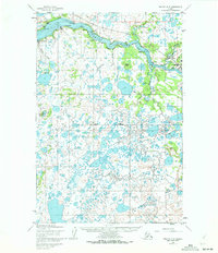
Editions of this 1952 Naknek C-3 Map
3 editions found
Other maps of this area

1952 · Naknek
USGS Topo · 1:250,000

1952 · Naknek D-2
USGS Topo · 1:63,360

1952 · Naknek B-3
USGS Topo · 1:63,360

1952 · Naknek B-4
USGS Topo · 1:63,360

1952 · Naknek B-2
USGS Topo · 1:63,360

1952 · Naknek C-2
USGS Topo · 1:63,360

1952 · Naknek C-3
USGS Topo · 1:63,360

1952 · Naknek D-3
USGS Topo · 1:63,360

1952 · Naknek D-4
USGS Topo · 1:63,360

1952 · Naknek C-4
USGS Topo · 1:63,360