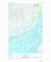
1952 Map of Naknek D-4
USGS Topo · Published 1981About this map
The Kvichak River and the complex tidal landscape of Bristol Bay dominate this 1952 coastal survey. The settlement of Naknek serves as a focal point near the river's mouth, while smaller outposts like Koggiung and Libbyville are positioned along the eastern shore. The geography is defined by extensive tidal flats and navigational hazards, including Salmon Flats, the Albert Channel, and the broad Kvichak Bay. Inland, the terrain is a dense network of small lakes and winding waterways such as Squaw Creek and Copenhagen Creek. A solitary Winter Trail cuts across the tundra north of Libbyville, highlighting the region's reliance on seasonal transport routes and water-based movement during the early 1950s. Local landmarks like Pederson Pt and Graveyard Pt provide essential orientation along the shifting coastline of the Bristol Bay Borough.
Find a feature on this map
20 named features on this map. Tap any name to fly to it.
Don’t see what you’re looking for? This feature index may not catch every label — zoom into the map to look around manually.
Map Details
Editions of this 1952 Naknek D-4 Map
3 editions found
Other maps of this area

1951 · Dillingham
USGS Topo · 1:250,000

1952 · Naknek
USGS Topo · 1:250,000

1952 · Naknek C-5
USGS Topo · 1:63,360

1952 · Dillingham A-4
USGS Topo · 1:63,360

1952 · Naknek C-3
USGS Topo · 1:63,360

1952 · Naknek D-5
USGS Topo · 1:63,360

1952 · Dillingham A-3
USGS Topo · 1:63,360

1952 · Naknek D-3
USGS Topo · 1:63,360

1952 · Naknek D-4
USGS Topo · 1:63,360

1952 · Naknek C-4
USGS Topo · 1:63,360