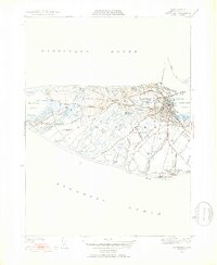
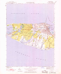
1951 Map of Nantucket
USGS Topo · Published 1952About this map
Nantucket serves as the dense hub of this 1951 revision, where a intricate network of streets including Pleasant St and Hulbert Avenue radiate from the harbor. Beyond the town center, the island's interior reveals a landscape of extensive moorlands and swamps, such as Millbrook Swamp and Larraby Swamp, interspersed with numerous coastal ponds like Long Pond and Miacomet Pond. This map details the island before the significant mid-century shifts in development, capturing established landmarks like the Cyrus Pierce Sch and several historic burial grounds, including the Old North Cem and Friends Cem. The western reach is defined by the small settlement of Maddaket and the long, sweeping curve of Maddaket Harbor, while the southern shore is punctuated by the isolated outpost at Surfside.
Find a feature on this map
72 named features on this map. Tap any name to fly to it.
Don’t see what you’re looking for? This feature index may not catch every label — zoom into the map to look around manually.
Map Details
Editions of this 1951 Nantucket Map
5 editions found
Other maps of this area

1887 · Muskeget
USGS Topo · 1:62,500

1889 · Muskeget
USGS Topo · 1:62,500

1889 · Nantucket
USGS Topo · 1:62,500

1893 · Nantucket
USGS Topo · 1:62,500

1893 · Muskeget
USGS Topo · 1:62,500

1899 · Muskeget
USGS Topo · 1:62,500

1901 · Nantucket
USGS Topo · 1:62,500

1942 · Nantucket
USGS Topo · 1:125,000

1944 · Tuckernuck Island
USGS Topo · 1:31,680

1945 · Nantucket
USGS Topo · 1:31,680