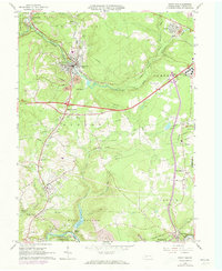
1964 Map of Nanty Glo
USGS Topo · Published 1973About this map
The Penn Central rail lines and the winding course of Blacklick Creek define this portion of Cambria County, where the industrial legacy of Pennsylvania's coal country is clearly visible. The borough of Nanty Glo serves as a central hub, surrounded by a landscape marked by strip mines and a large mine dump to its south. The 1972 revisions reveal the expansion of the Ebensburg State School complex and the development of the Ebensburg Airport along the eastern edge, showing the area's transition toward institutional and regional infrastructure. Genealogists will find significant value in the documentation of several family and parish landmarks, including St Marys Cem, St Pauls Ch, and the rural Summit Chapel. From the waters of Saltlick Reservoir to the clustered settlements of Twin Rocks and Mineral Point, the map captures a period when heavy industry and established small-town communities remained the primary features of the local terrain.
Find a feature on this map
52 named features on this map. Tap any name to fly to it.
Don’t see what you’re looking for? This feature index may not catch every label — zoom into the map to look around manually.
Map Details
Editions of this 1964 Nanty Glo Map
4 editions found
Other maps of this area

1902 · Ebensburg
USGS Topo · 1:62,500

1902 · Patton
USGS Topo · 1:62,500

1902 · Barnesboro
USGS Topo · 1:62,500

1904 · Barnesboro
USGS Topo · 1:62,500

1904 · Patton
USGS Topo · 1:62,500

1904 · Ebensburg
USGS Topo · 1:62,500

1904 · Johnstown
USGS Topo · 1:62,500

1907 · Johnstown
USGS Topo · 1:62,500

1943 · Punxsutawney
USGS Topo · 1:125,000

1953 · Pittsburgh
USGS Topo · 1:250,000