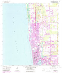
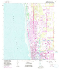
1958 Map of Naples North
USGS Topo · Published 1988About this map
Vanderbilt Beach and the coastal edges of Collier County show the intense mid-century transformation of the Florida Gulf Coast. This map captures the evolving shoreline where natural features like Clam Pass and Doctors Pass meet an expanding network of dredged canals and residential developments. To the south, the city of Naples serves as the primary hub, anchored by the Naples Airport and the historic Gordon River corridor.
Find a feature on this map
35 named features on this map. Tap any name to fly to it.
Don’t see what you’re looking for? This feature index may not catch every label — zoom into the map to look around manually.
Map Details
Editions of this 1958 Naples North Map
6 editions found
Other maps of this area

1956 · West Palm Beach
USGS Topo · 1:250,000

1957 · West Palm Beach
USGS Topo · 1:250,000

1958 · West Palm Beach
USGS Topo · 1:250,000

1958 · Bonita Springs
USGS Topo · 1:24,000

1958 · Belle Meade
USGS Topo · 1:24,000

1958 · Naples South
USGS Topo · 1:24,000

1958 · Belle Meade NW
USGS Topo · 1:24,000

1958 · Corkscrew SW
USGS Topo · 1:24,000

1958 · Naples North
USGS Topo · 1:24,000
1985 · Naples
USGS Topo · 1:100,000