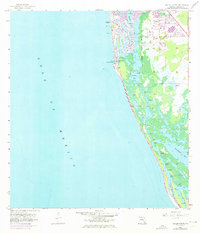
1958 Map of Naples South
USGS Topo · Published 1973About this map
Naples is the central focus of this coastal study, which reflects the early 1970s expansion of the city alongside its mid-century topographic foundations. The map documents the intricate network of residential canals and dredged waterways that define the shoreline, with the Naples City Boundary extending through the southern wetlands. The maritime character of the area is emphasized by several key water bodies, including Naples Bay and Dollar Bay, which lead toward the open Gulf of Mexico.
Find a feature on this map
10 named features on this map. Tap any name to fly to it.
Don’t see what you’re looking for? This feature index may not catch every label — zoom into the map to look around manually.
Map Details
Editions of this 1958 Naples South Map
5 editions found
Other maps of this area

1956 · Miami
USGS Topo · 1:250,000

1956 · West Palm Beach
USGS Topo · 1:250,000

1957 · West Palm Beach
USGS Topo · 1:250,000

1958 · West Palm Beach
USGS Topo · 1:250,000

1958 · Miami
USGS Topo · 1:250,000

1958 · Belle Meade
USGS Topo · 1:24,000

1958 · Naples South
USGS Topo · 1:24,000

1958 · Belle Meade NW
USGS Topo · 1:24,000

1958 · Naples North
USGS Topo · 1:24,000

1973 · Marco Island
USGS Topo · 1:24,000