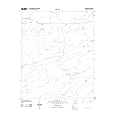
2012 Map of Nashoba
USGS Topo · Published 2012About this map
Nashoba sits at the northern edge of this terrain in Pushmataha County, where the Black Fork and Cripple Cr converge. The landscape is defined by the winding course of the Little River, which snakes southward through the center of the quadrangle, flanked by prominent features like Musket Mtn. This area reflects a deep-rooted cultural history, evidenced by the presence of the Nashoba Indian Cem and Black Fork Cem near the primary settlement.
Find a feature on this map
55 named features on this map. Tap any name to fly to it.
Don’t see what you’re looking for? This feature index may not catch every label — zoom into the map to look around manually.
Map Details
Editions of this 2012 Nashoba Map
This is the sole edition of this map. No revisions or reprints were ever made.
Other maps of this area

1901 · Tuskahoma
USGS Topo · 1:125,000

1901 · Alikchi
USGS Topo · 1:125,000

1908 · Tuskahoma
USGS Topo · 1:125,000

1909 · Tuskahoma
USGS Topo · 1:125,000

1950 · Mcalester
USGS Topo · 1:250,000

1962 · McAlester
USGS Topo · 1:250,000

1962 · Caney Mountain
USGS Topo · 1:24,000

1962 · Signal Mountain
USGS Topo · 1:24,000

1965 · McAlester
USGS Topo · 1:250,000
1971 · Albion SE
USGS Topo · 1:24,000