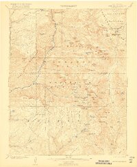
1902 Map of Needle Mountains
USGS Topo · Published 1917About this map
The Continental Divide snake through this high-altitude landscape at the turn of the century, defining a wilderness where early industry and transportation clung to the river valleys. The Denver and Rio Grande Railroad follows the narrow corridor of the Animas River, providing the primary connection for remote outposts like Needleton and Elk Park. Higher in the peaks, evidence of mineral prospecting appears at the Quartz Mill near the headwaters of the Florida River and the Upper Park Reservoir. The map reveals the early boundaries of the Rio Grande National Forest and the rugged separation between San Juan and La Plata Counties. Significant alpine basins such as Chicago Basin and Vallecito Basin are detailed alongside the prominent Grenadier Range, showing the area before modern recreational development when it was primarily the domain of miners and rail workers.
Find a feature on this map
86 named features on this map. Tap any name to fly to it.
Don’t see what you’re looking for? This feature index may not catch every label — zoom into the map to look around manually.
Map Details
Editions of this 1902 Needle Mountains Map
4 editions found
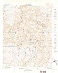
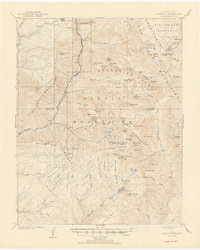
Other maps of this area

1897 · Telluride
USGS Topo · 1:62,500

1897 · Silverton
USGS Topo · 1:62,500

1898 · Durango
USGS Topo · 1:62,500

1898 · Engineer Mountain
USGS Topo · 1:62,500

1900 · Engineer Mountain
USGS Topo · 1:62,500

1900 · Needle Mountains
USGS Topo · 1:62,500

1901 · Silverton
USGS Topo · 1:62,500

1902 · Needle Mountains
USGS Topo · 1:62,500

1902 · Silverton
USGS Topo · 1:62,500

1904 · Telluride
USGS Topo · 1:62,500