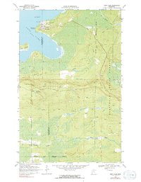
1969 Map of Nett Lake
USGS Topo · Published 1991About this map
Nett Lake and the surrounding wilderness of northern Minnesota are defined by a network of seasonal routes and forest management boundaries in the late 1960s. The settlement of Nett Lake sits at the water's edge, supported by infrastructure including the Nett Lake Ranger Station and a nearby Radio Tower. The landscape is characterized by its transition from open water to marshy wetlands, punctuated by landforms like Big Point and Big Island.
Find a feature on this map
19 named features on this map. Tap any name to fly to it.
Don’t see what you’re looking for? This feature index may not catch every label — zoom into the map to look around manually.
Map Details
Editions of this 1969 Nett Lake Map
2 editions found

Other maps of this area

1954 · Hibbing
USGS Topo · 1:250,000

1954 · International Falls
USGS Topo · 1:250,000

1957 · Hibbing
USGS Topo · 1:250,000

1957 · International Falls
USGS Topo · 1:250,000

1958 · International Falls
USGS Topo · 1:250,000

1958 · Hibbing
USGS Topo · 1:250,000

1964 · Hibbing
USGS Topo · 1:250,000

1964 · Gheen NW
USGS Topo · 1:24,000

1968 · Ash Lake
USGS Topo · 1:24,000

1968 · Orr SW
USGS Topo · 1:24,000