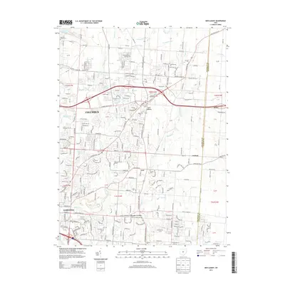
2013 Map of New Albany
USGS Topo · Published 2013About this map
New Albany serves as a central hub in this detailed look at northeast Columbus, where the suburban expansion of the early 21st century meets long-established rural landscapes. The topography is defined by the drainage networks of Blacklick Cr and Rocky Fork Cr, along with numerous man-made agricultural improvements like Bevelheimer Ditch and Cole Ditch. The map documents a high density of ancestral burial grounds, including Burnside Cem, Dague Cem, and Headley Cem, which anchor the modern road network to the area's pioneer history. Local crossroads such as Havens Corners and Ovid maintain their identity amidst growing residential developments. Significant landmarks such as the Hoover Reservoir in the northwest corner and the Saint Pauls Lutheran Ch provide clear spatial orientation for researchers tracing the evolution of Franklin and Licking counties.
Find a feature on this map
139 named features on this map. Tap any name to fly to it.
Don’t see what you’re looking for? This feature index may not catch every label — zoom into the map to look around manually.
Map Details
Editions of this 2013 New Albany Map
This is the sole edition of this map. No revisions or reprints were ever made.
Other maps of this area

1902 · Westerville
USGS Topo · 1:62,500

1904 · Westerville
USGS Topo · 1:62,500

1907 · Thurston
USGS Topo · 1:62,500

1908 · Granville
USGS Topo · 1:62,500

1909 · Thurston
USGS Topo · 1:62,500

1910 · Granville
USGS Topo · 1:62,500

1925 · East Columbus
USGS Topo · 1:62,500

1943 · East Columbus
USGS Topo · 1:62,500

1947 · Columbus
USGS Topo · 1:250,000

1950 · Marion
USGS Topo · 1:250,000