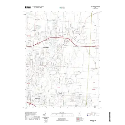
2019 Map of New Albany
USGS Topo · Published 2019About this map
New Albany and the eastern suburbs of Columbus define this 2019 landscape, where suburban expansion meets the historic creek valleys of Franklin Co and Licking Co. The terrain is shaped by the drainage networks of Blacklick Cr and Rocky Fork Cr, which historically dictated the placement of early homesteads and roads. The area retains significant genealogical landmarks through its numerous burial grounds, including the Saint Pauls Lutheran Cem and Burnside Cem. Evidence of older rural clusters persists at Havens Corners, even as modern residential developments fill the spaces between the traditional township lines. This map documents a period of rapid change, where former agricultural lands and ditches like Bevelheimer Ditch now neighbor dense neighborhood grids and modern parkways.
Find a feature on this map
231 named features on this map. Tap any name to fly to it.
Don’t see what you’re looking for? This feature index may not catch every label — zoom into the map to look around manually.
Map Details
Editions of this 2019 New Albany Map
This is the sole edition of this map. No revisions or reprints were ever made.
Other maps of this area

1902 · Westerville
USGS Topo · 1:62,500

1904 · Westerville
USGS Topo · 1:62,500

1907 · Thurston
USGS Topo · 1:62,500

1908 · Granville
USGS Topo · 1:62,500

1909 · Thurston
USGS Topo · 1:62,500

1910 · Granville
USGS Topo · 1:62,500

1925 · East Columbus
USGS Topo · 1:62,500

1943 · East Columbus
USGS Topo · 1:62,500

1947 · Columbus
USGS Topo · 1:250,000

1950 · Marion
USGS Topo · 1:250,000